
article written by Ashley Howard
ASSESSING DISASTER RECOVERY THROUGH TEMPORARY RESETTLEMENTS. LA PALMA – CANARY ISLANDS.
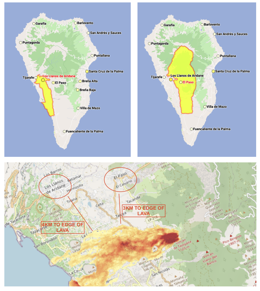
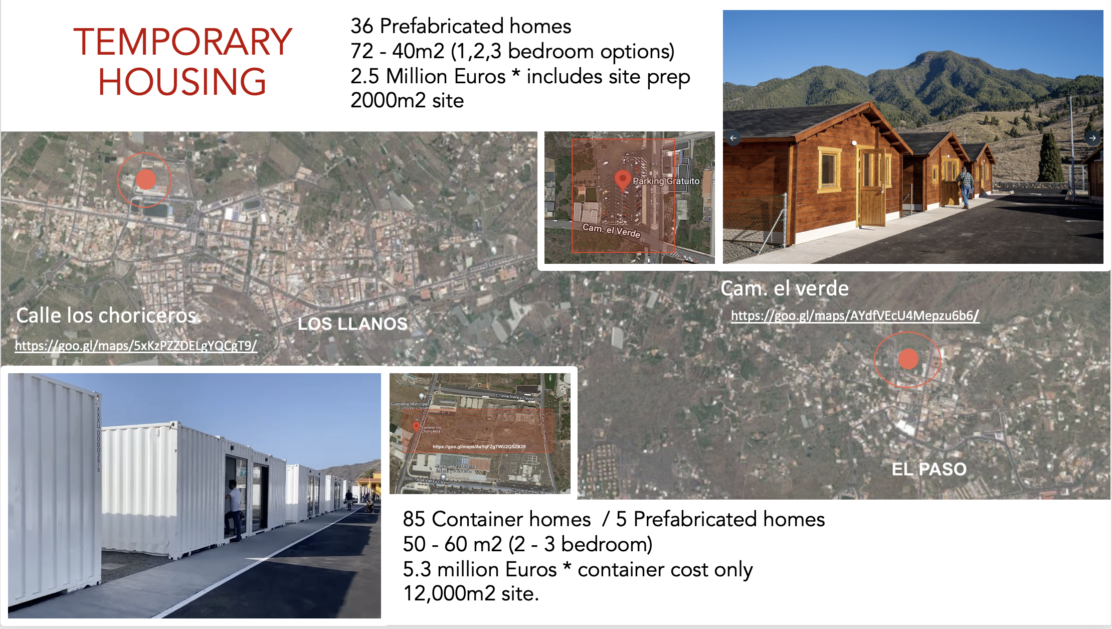
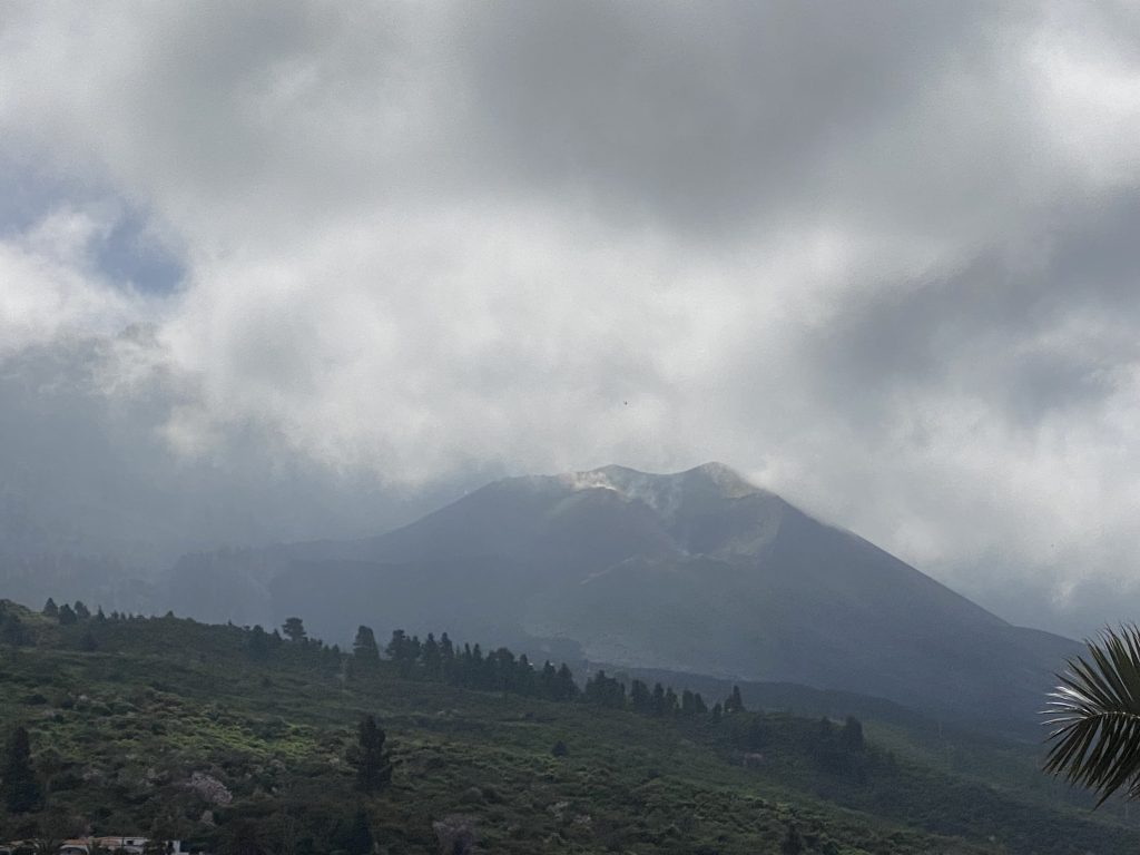
On the 19th of September 2021, the active volcano, Cumbre Vieja, erupted on the island of La Palma, Canarias, discharging volcanic magma and tephra for a duration of 85 days. From the eruption, over 1400 homes were destroyed, towns were laden in permanent lava and 5000+ people were unable to return to their houses and land. Today, recuperation is still ongoing, and many displaced communities and families are making long-term transitions into temporary housing resettlements. To assist in the ongoing recovery effort of La Palma, this year’s International Urban Regeneration Studio [IURS] partnered with the active recovery organisation, the Spanish Red Cross, alongside consulting with the community-based organisation, Revivir El Valle. The aim of the collaboration was to analyse the ongoing resettlement processes of the island and to understand how impacted local communities are regaining their physical and social identities after the event. To do so, our MICSEA team was tasked with conducting a rapid assessment of two temporary resettlement projects, one site of modified container housing in the municipality of Los Llanos de Aridane and the other of wooden prefabricated dwellings in the municipality of El Paso.
STAKEHOLDERS
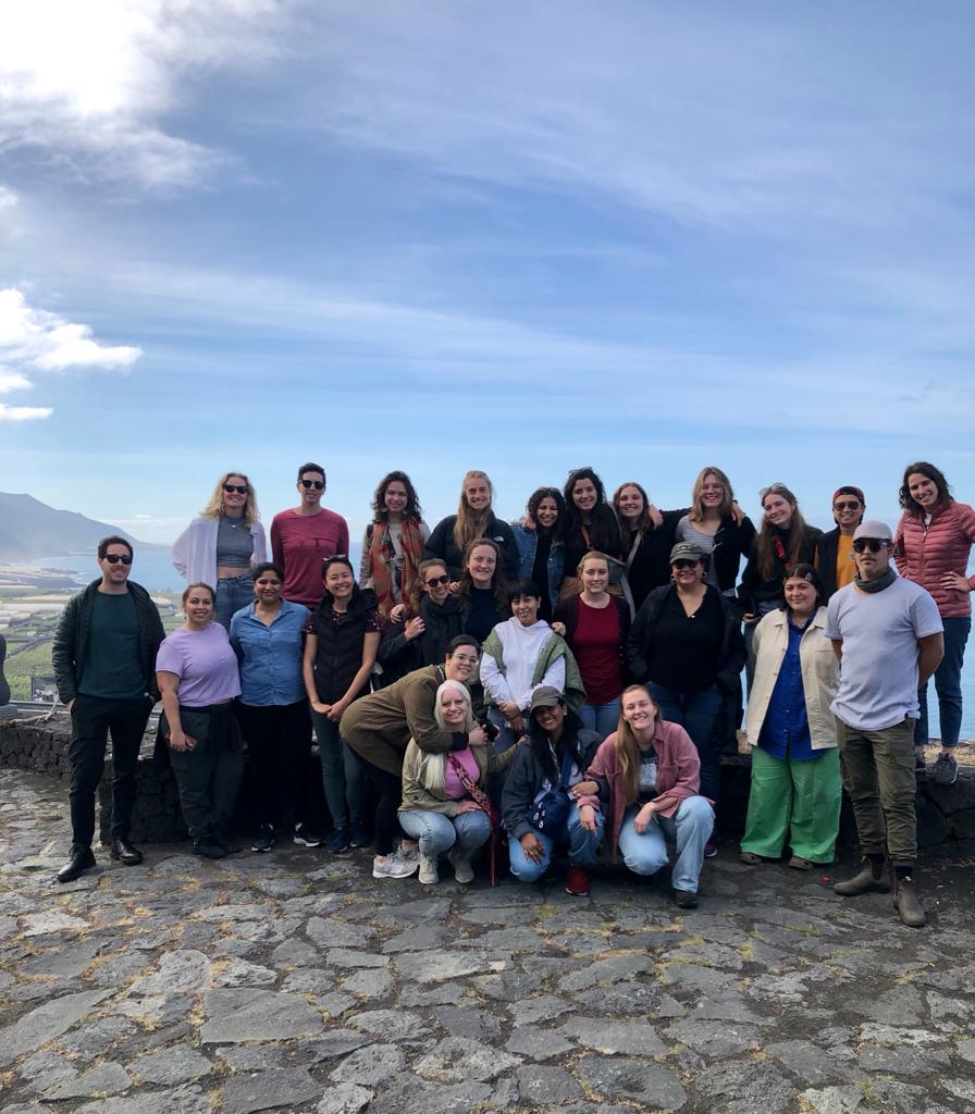
To make the 2023 studio possible, this year’s programme was led by director and professor Carmen Mendoza Arroyo, alongside Ashley Howard from the UIC, and visiting researcher and PhD Candidate, Fabio Di Iorio. In addition to our regular group of 18 talented postgraduates, the studio was joined by 5 students from our long-term partners of the Master of Disaster, Design and Development degree at RMIT University. Together the MICSEA team of 23 made a multicultural and interdisciplinary all-female alliance.
Partners from the Spanish Red Cross comprised of architect Luis Carrasco, and local members of the La Palma branch, Vanesa Garcia and Verónica Candelaria. Partners from Revivir El Valle included the programme director Vicente Zapata and anthropologist and cultural expert, Alejandro Rodrigues. Additional collaborators were Candelera Delgado from the Instituto Canario de Vivienda, who joined us on behalf of the regional government, and Laura Ramiro, from the organisation Mestura, who shared the work they are conducting in the field.
OBJECTIVES
The research practices used for the workshop were carefully designed to benefit both local stakeholders and to facilitate a progressive learning environment for our student participants. The objectives agreed upon by all partners for the programme were:
- To develop a physical assessment of the relocation neighbourhoods of Los Llanos and El Paso from a settlement to a typological analysis.
- To recover through community mapping, the places of urban significance for the people of the two neighbourhoods, in order to highlight potential spaces for future recovery.
- To analyse the recovery process and how it is meeting the needs of stakeholders.
The overall goals were to assist our partners with their advocacy work alongside introducing our students to research scenarios, with the purpose of enhancing learning and fieldwork experiences.


WORKSHOP TIMELINE
STEP ONE – OFFSITE SPATIAL DIAGNOSIS
January 23rd – 26th & March 2nd / * at the UIC in Barcelona Spain
Commencing the workshop in January, UIC students dove into a rapid analysis of La Palma, by collecting research to understand what life was like in the two communities of Los Llanos and El Paso before the volcanic eruption. This step was underpinned by examining secondary resources to help analyse, map and explore information on four main topics.
Group 1: Green/Blue Infrastructure & Open Spaces
Group 2: Culture & Livelihoods
Group 3: Mobility & Infrastructure
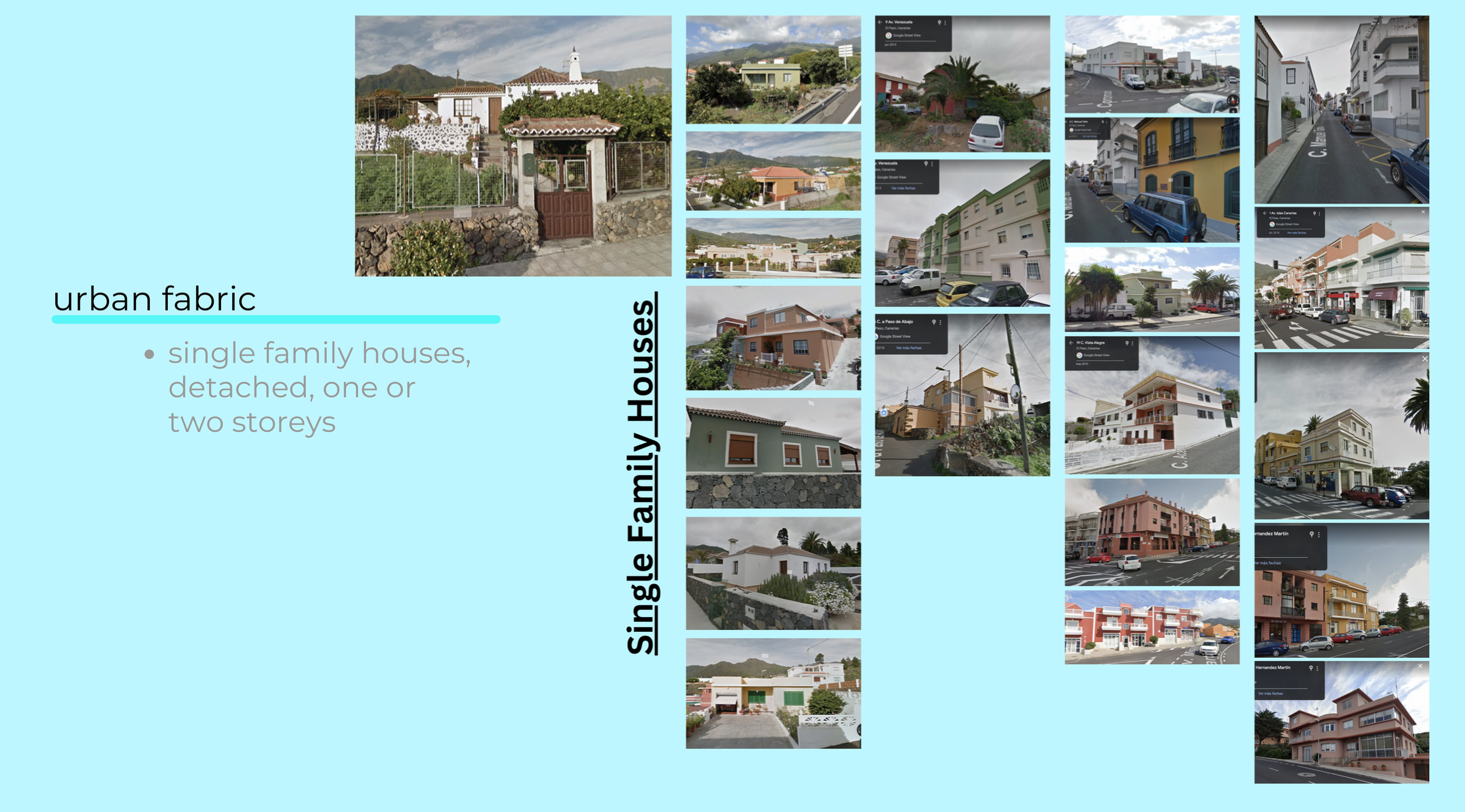
Group 4: Urban Fabric & Typologies
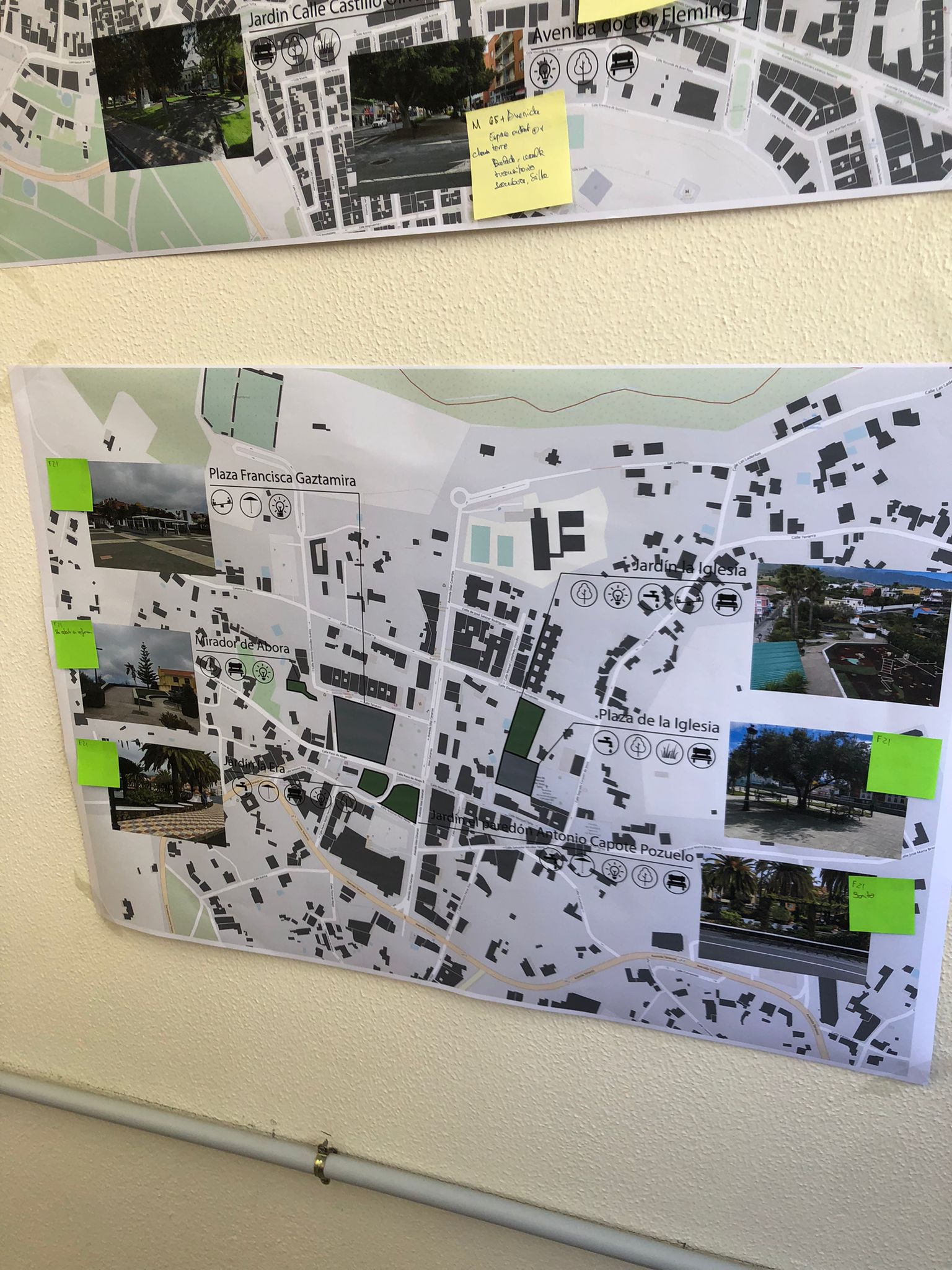
Within this step, Group 1 – investigated the green infrastructure of La Palma by exploring local landscapes, topographies, natural elements, agriculture areas and bio-reserves. In addition, they presented a rudimentary look into blue infrastructure, assessing waterways, access to freshwater sources, and water for farming and irrigation. Lastly, the group examined the two municipality regions for open spaces, parks, plazas, urban gardens, and potential voids.
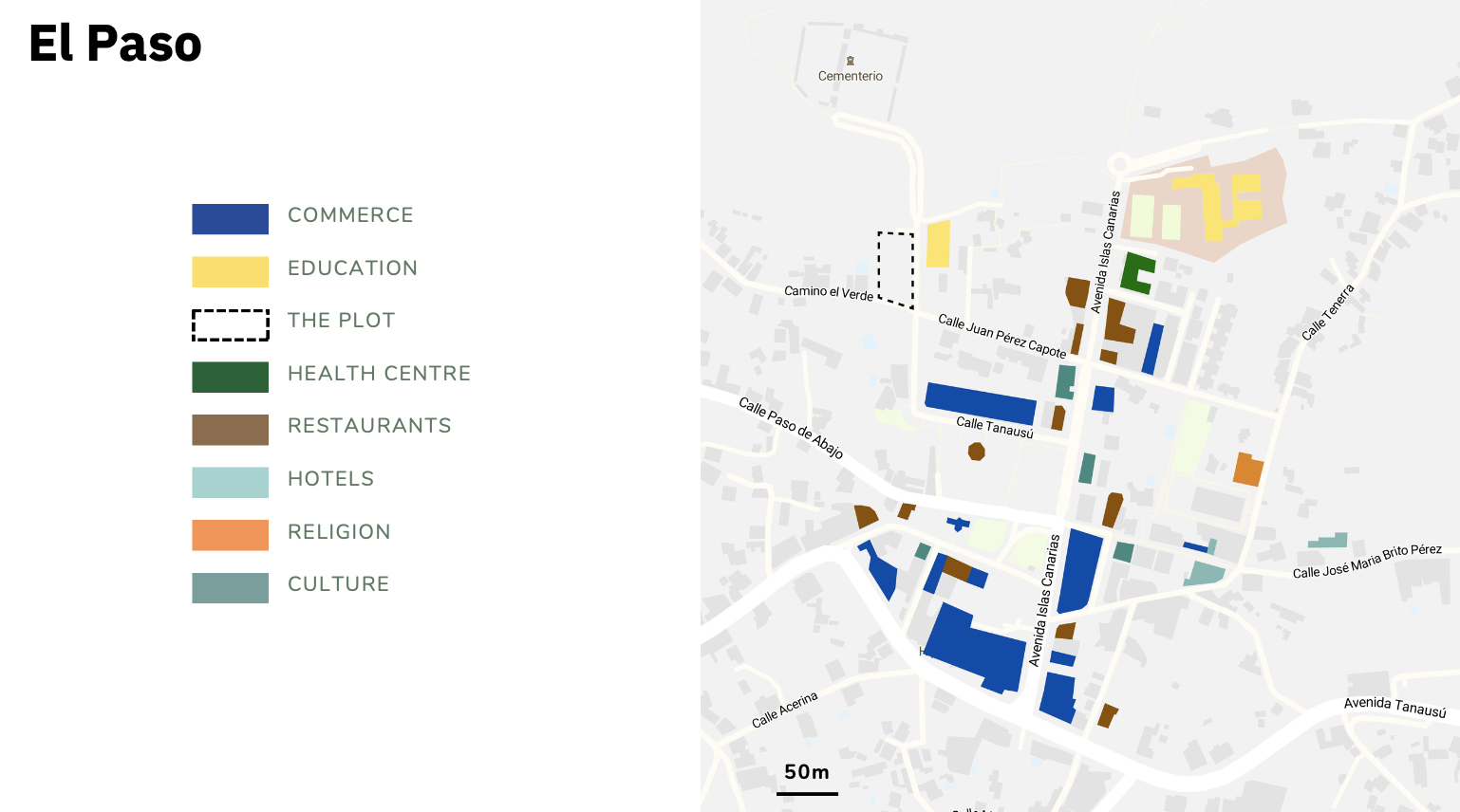
Group 2 – explored the different types of local livelihoods, the historical background of the island and the current tourism, agriculture, and employment sectors. They also attempted to map activities, industry, markets, and food production.
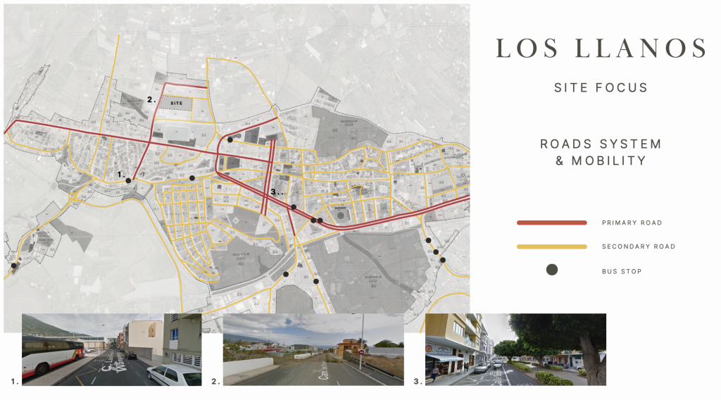
Group 3 – built an informative map of the civil infrastructure on the southwest side of La Palma, including public transport, roadway systems and road network hierarchies. Furthermore, they mapped pedestrian connectivity and distances to vital services.
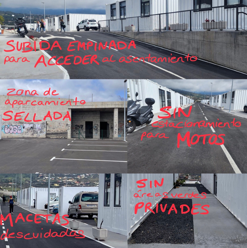
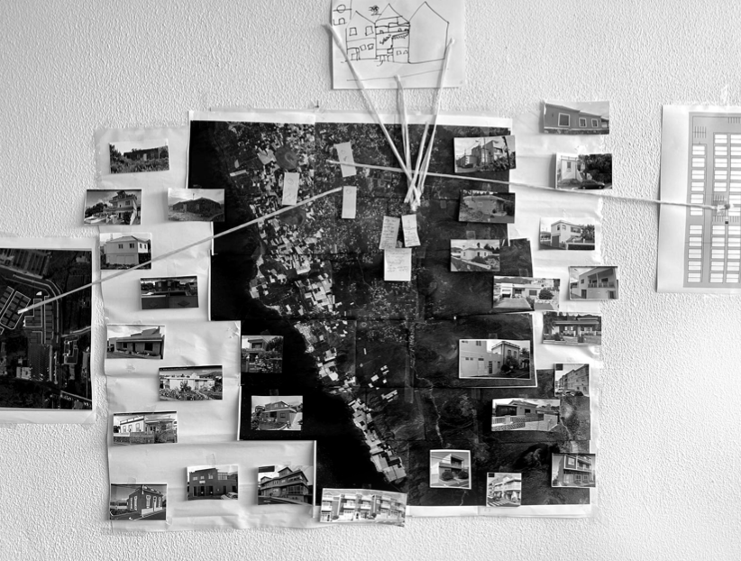
Group 4 – analysed the different housing typologies of the two municipalities, alongside the density of the urban fabric and regional zones surrounding the areas impacted by the volcano. Their findings also showcased the types of homes and buildings lost in the volcanic event.
At the end of the initial offsite diagnosis, the UIC students presented their rapid analysis to the Spanish Red Cross, who provided critical feedback to help sharpen the assessments and bring them closer to the local context. The workshop then took a break and recommenced in early March, where the RMIT students joined the study and were onboarded with the revised research from the UIC groups. The new MICSEA team then prepared for entering the field by having an information session and discussions with the Red Cross and Revivir El Valle.

STEP TWO – ONSITE PHYSICAL ASSESSMENT
MARCH – 7th – 9th / La Palma, Canary Islands
Step Two – involved an onsite physical assessment of the areas impacted by the volcano’s lava as well as verification of the research conducted in the offsite spatial diagnosis. Furthermore, the step involved the production of new primary data by conducting observation research and physical mapping in a 400m radius around the two temporary resettlements.
After arriving on the island of La Palma, the MICSEA team met at the Red Cross headquarters and engaged in questioning with the project partners to expand their knowledge of the impacted communities and areas. They also participated in talks with the NGO Mestura, who shared their methods of place-making and how they were working with people displaced by the volcanic event. To round off the induction, researcher Fabio Di Iorio, presented a comprehensive example of a post-disaster strategy on the island of Ischia, and Ashley Howard addressed the team with a lecture on intercultural practices, fieldwork methods and research planning.
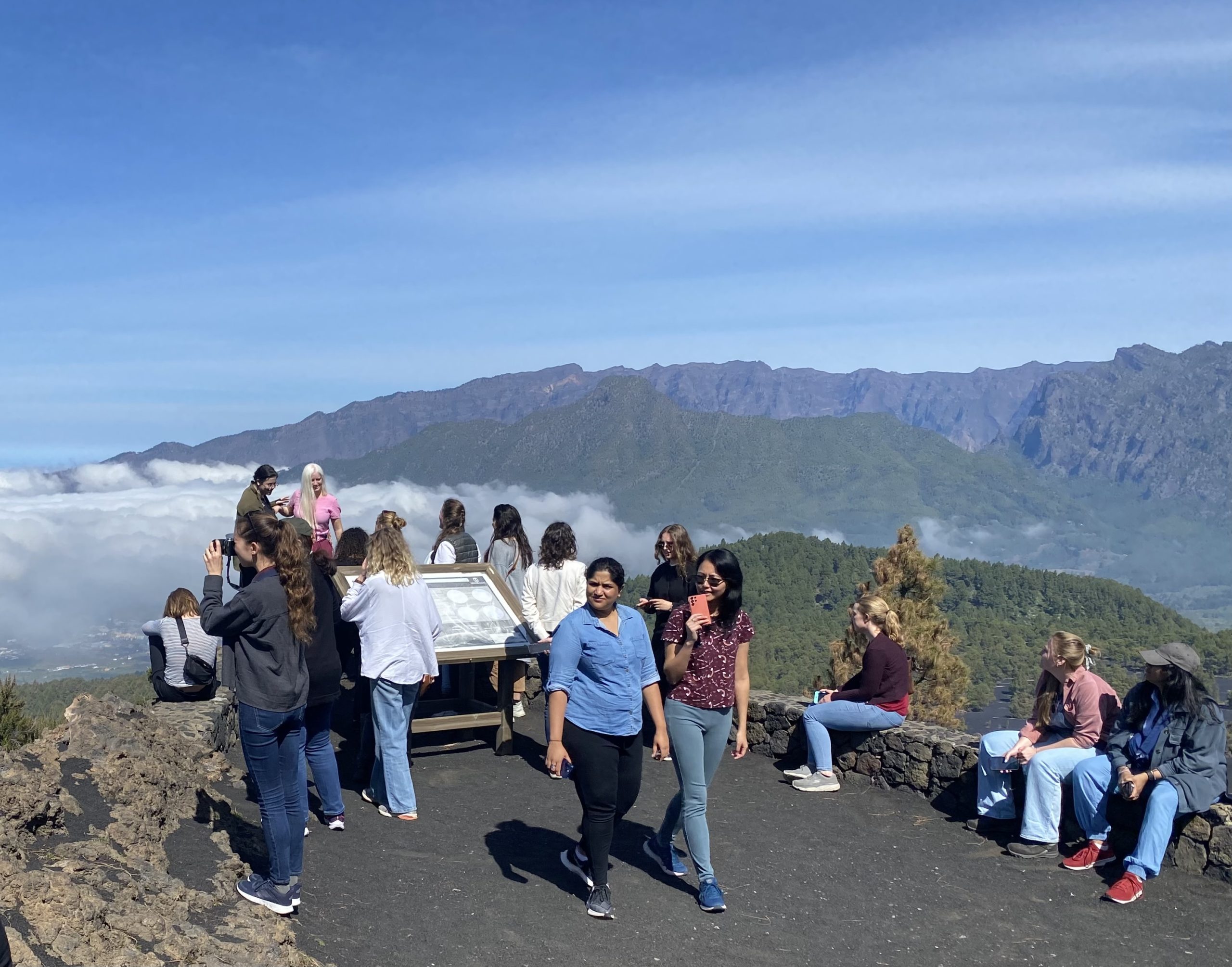
The following day the physical assessment kicked off with a bus trip into the hardened lava zone and visits to the affected areas surrounding the volcanic eruption. This included where the magma reached the ocean on the coastline at Puerto Naos, the spared town of Las Manchas under the main volcanic vent, and a trip to the Cumbre Vieja ridge, above the volcanic peaks of the island.
The second part of the day saw the teams split into their groups and move around on foot to verify their offsite data in both El Paso and Los Llanos. This time was used as an opportunity to collect ground information and make observations of the surrounding environment and fabrics of the two resettlement projects.
Group 1 – focused on the existing green sites and open space systems on a town scale, whilst Group 2 – concentrated on verifying the services and activities being used in the neighbourhoods adjoining the resettlement projects. Group 3 – took on the large tasks of confirming the preferred types of mobility used by the public, as well as determining what transport modalities were available in the area. And Group 4 – conducted a closer look at the typologies of the two resettlements and surveyed how the housing types were integrated into the surrounding urban environments. At the end of the day, the team met up at the Revivir El Valle headquarters, where the organisation presented a more detailed explanation of their work, and the qualitative research models they were using to capture the voices of the local community and to inform the incoming government reconstruction plan.


STEP THREE – SOCIAL APPROACHES
MARCH – 9th – 12th
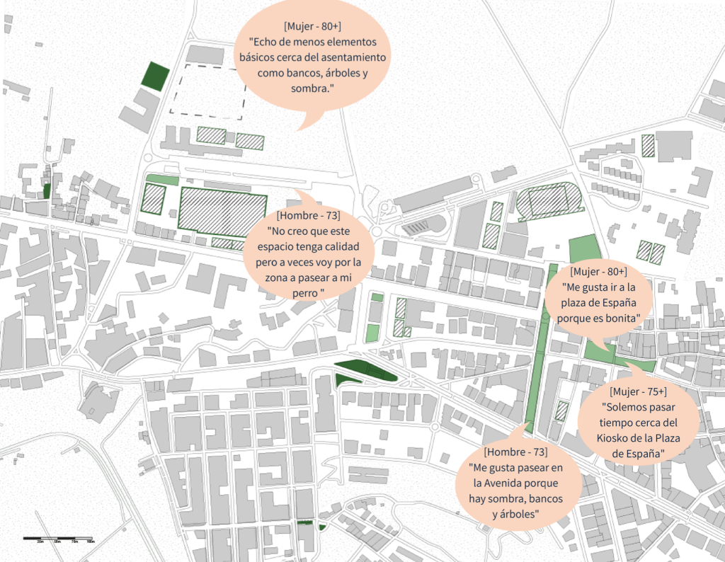
Step three involved the development of qualitative research techniques to be conducted with the workshop stakeholders. The purpose of this step was to socially map the community’s past and present-day lives, as well as their opinions and experiences during the resettlement and recovery process. To do so, the MICSEA methodology focused on three qualitative approaches: activity-based focus groups, semi-structured interviews and walkalongs with members of the resettlement projects.
To prepare for this stage, the MICSEA team took a day to debrief the step 2 findings and develop strategies for their qualitative engagements. To assist in this process and define a more colloquial understanding of the community, Alejandro Rodriguez delivered a compelling lecture on the cultural aspects of La Palma.
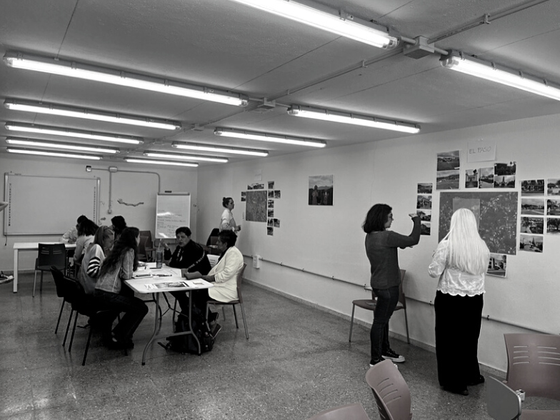
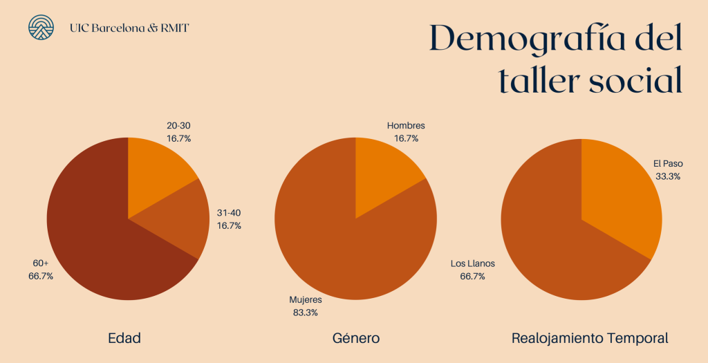
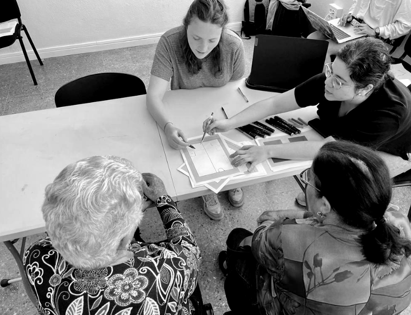
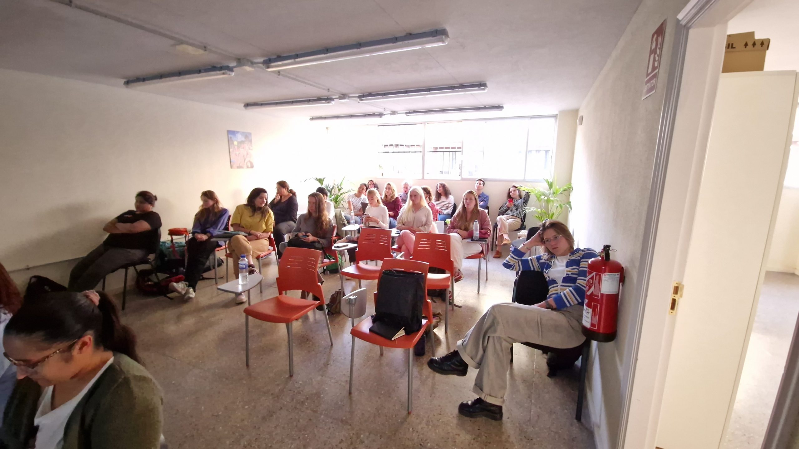
Moving into the second day of the social approaches, the MICSEA team hosted an in-house event at the Red Cross, where they invited community members to come and engage in discussions and activities related to the group topics and recovery processes. Overall, the day was considered a success and 6 participants joined the focus groups and activities.
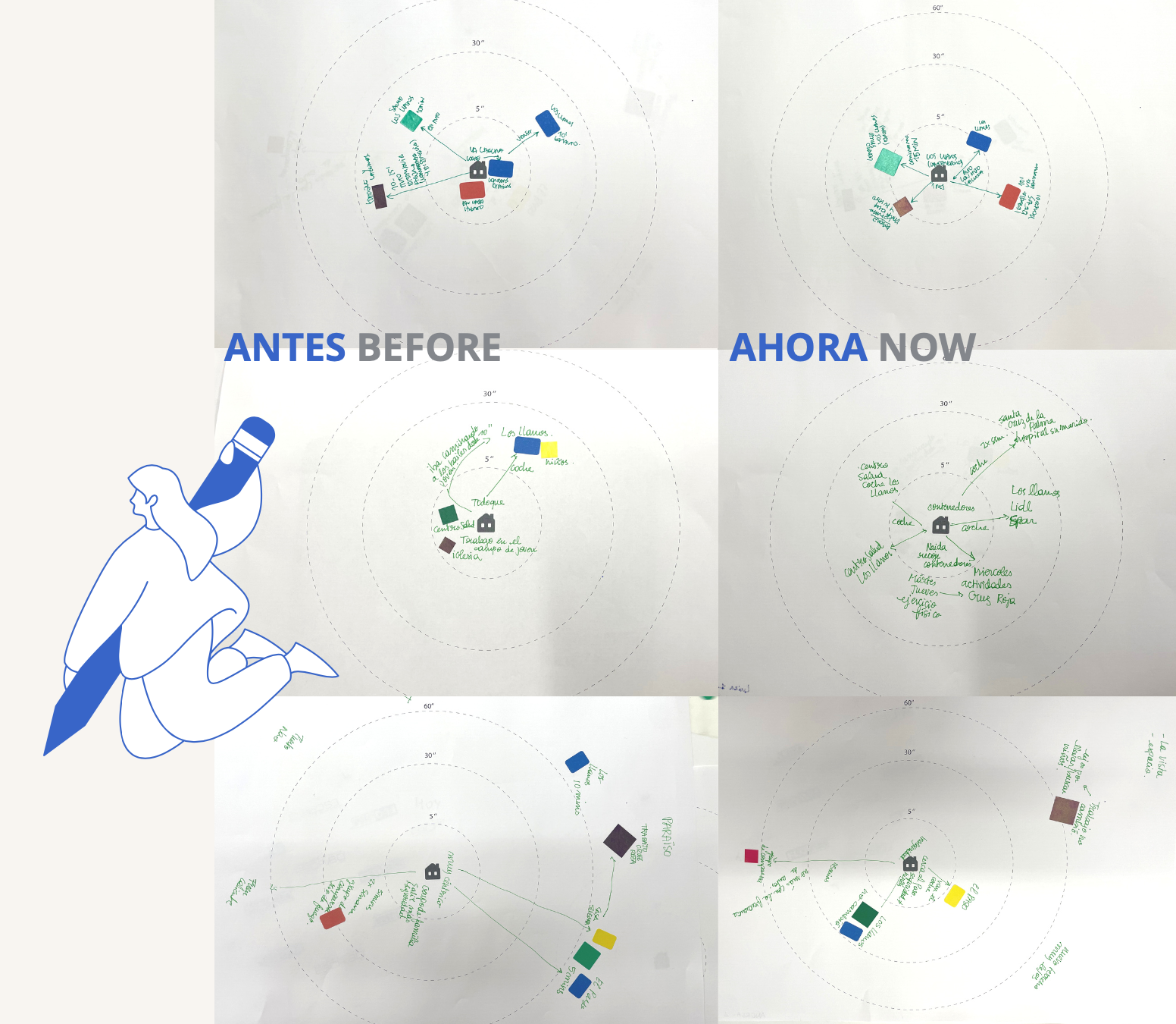
Group 1 – used pin-up charts to identify what aspects of open spaces the people wanted, alongside presenting pictures of existing areas to see what public spaces were being used the most. Group 2 – used a drawing-based before-and-after exercise to help identify the changes that occurred in the daily lives of the community and their uses of facilities since the disaster. Group 3 – displayed visual maps and images of places of significance to help trace out the new routes and pathways of the members living in the resettlement projects. Group 4 – presented different examples of housing typologies in the region and built a link analysis to create a mind map of the urban fabric. They also performed drawing and memory exercises, where they had their participants sketch their previous home layouts versus the floorplans of the new resettlement houses. To expand the reach of the social approaches, community members were then asked if they would like to engage further with the students for one-on-one interviews and walk alongs in their daily lives. In addition, the Red Cross also contacted different members from the resettlement projects and extended invites to contribute to the workshop research. As a result, the groups conducted 10 additional semi-structured interviews in the resettlement projects and 2 walk-along in the surrounding neighbourhood. This component of the workshop was very powerful, and not only did the MICSEA team gain learnings from their research objectives, but they also had the opportunity to immerse themselves in a humbling environment, share knowledge and absorb the true wisdom from the people and places in La Palma.


STEP FOUR – SOCIAL & SPATIAL INTEGRATION
MARCH – 13th – 15th
The first component of this step involved each group cross-analysing the physical and qualitative data they collected, and then exploring how their findings could address the research questions and workshop objectives. The second component involved the development of rudimentary recommendations and suggestions for phased strategies that could be implemented to better the ongoing recovery process. And the final component entailed the dissemination of the overall findings in a simplified presentation to the workshop stakeholders.
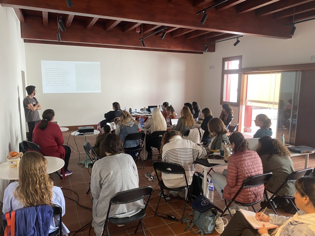
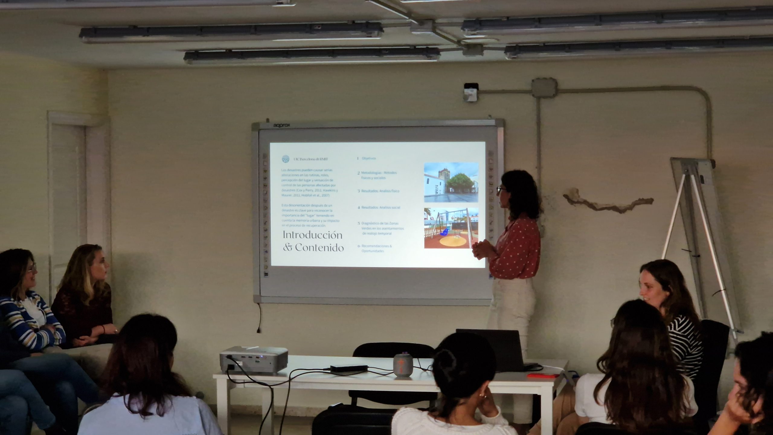
After a short break exploring the island, the MICSEA team embarked on the last step of the workshop, which involved integrating the social and spatial data into a synthesised evaluation, and then presenting what findings and recommendations came from the overall analysis. This step introduced a change in pace for the workshop activities and allowed groups to work for three days in a shared space at their own capacity. The venue ‘Prunus’ was a highlight for the groups, a 17th-century converted house with several unique workspaces. To support the socio–spatial integrations, Carmen Mendoza made several interactions with the groups sharing her knowledge and experience to help guide their ideas and plan the most appropriate methods for disseminating the research findings.
To conclude the final step, each group designed their presentations and delivered them in Spanish to members of the Red Cross, Revivir El Valle, the Instituto Canario de Vivienda and Mestura.
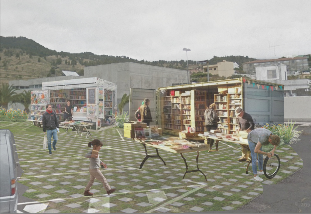
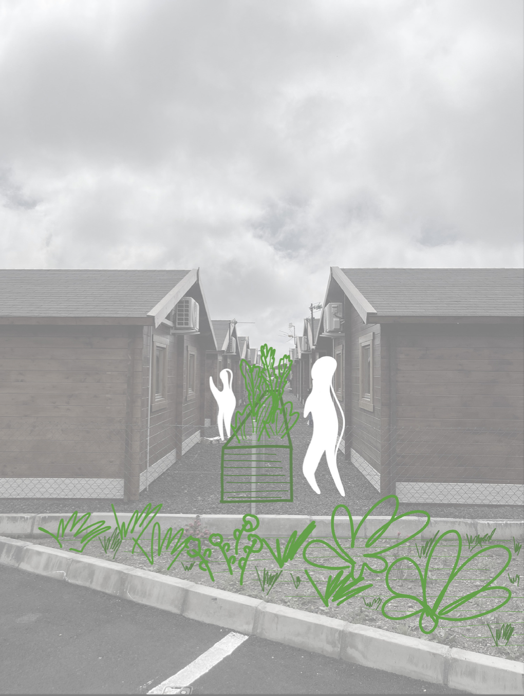
Group 1 – introduced the International Urban Regeneration Studio, followed by a succinct summary of their research strategy. Their methods focused on highlighting open space areas of significance around the sites, followed by suggestions of phased tactical urbanism for public spaces, which was a recurrent claim of the community to better the immediate environment within the resettlement boundaries.
Group 2 – presented a summary of their outcomes from the physical and social approaches, alongside a detailed representation of stakeholder voices and needs. Their recommendations introduced staged community programmes that could bring activities and social events closer to the resettlement locations.
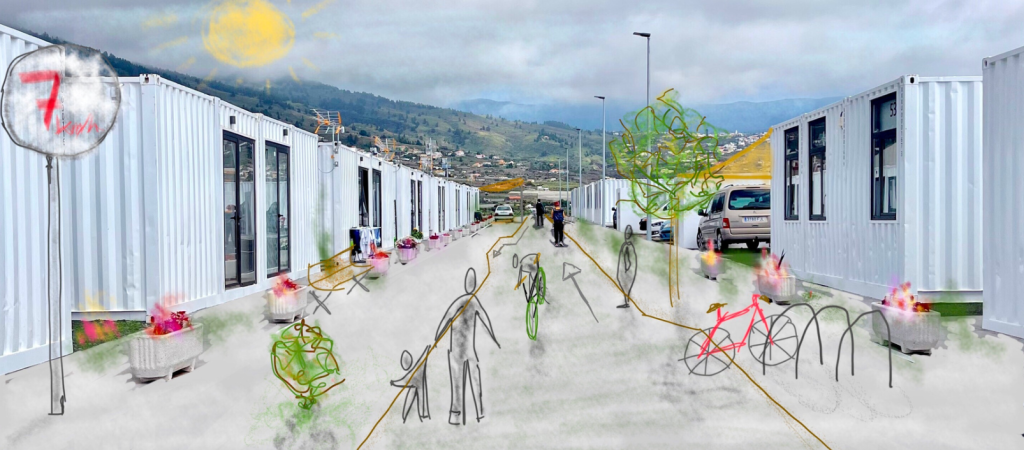
Group 3 – displayed a chronological summary of their methodology alongside an analysis of the percentages of space being delegated for pedestrian and automobile use in the resettlement zones. Their recommendations explored subtly changing the use of cars and roads in the resettlement ground in order to make provisions for open spaces, activities, and shared pedestrian spaces.
Group 4 – finished the event with a visual representation of their process of research alongside a detailed analysis that focused directly on the typologies of the resettlement houses. As part of their suggestions, they exemplified possible staged modifications that can be made to the resettlement housing structures.
The group presentations were well received and showed the extraordinary efforts of all those involved in such a short amount of time. This was especially evident with the Spanish speakers of the MICSEA team, who were given additional tasks to translate and ensure that the workshop content was disseminated in the local language. In addition to the final presentation, the groups were also tasked to submit a comprehensive document collaborating all their research and findings, which will be hosted in an online drive and made available for all those who were involved in the project.

REFLECTIONS
The MICSEA team adopted a community-based perspective and interrogated the temporary resettlement projects from a social, political, and cultural lens. The way they approached the methodology exemplified how physical and qualitative mapping techniques can be used to analyse different territorial layers of significance that can assist in highlighting areas of need in a complex recovery process. The fieldwork and social exercises helped generate a snapshot of the resettlement environments as well as providing critical learning curves for both the student and the programme. The MICSEA groups engaged in and ethically handled input from their research partners to create a simple but effective social-spatial analysis that can potentially build ties for repair.
Moving forward, the International Urban Regeneration Studio intends to further contribute to the efforts and work being developed by our partners and hopes to expand the research results into a more detailed project benefiting the local stakeholders.

We thank all those who were involved in the workshop, our partners at the Spanish Red Cross and Revivir El Valle, the communities of Los Llanos and El Paso, who welcomed us into their homes and shared their stories, and to the MICSEA team and faculty, who carried themselves as respectful and engaging researchers.