INITIAL PHYSICAL ASSESSMENT AT A NEIGHBORHOOD SCALE
Following the Introductory Context Workshop held on February 18th and 19th, the UIC and project partners have now entered the design stage of the Bourj Hammoud recovery and reconstruction – post-disaster proposal. This has been split into two phases; the first being an initial physical assessment at a neighbourhood scale and the second addressing the open space regeneration. Phase one was successfully held before the Easter break on the 22nd – 26th March and saw the return of university students from AUB, Chalmers and RMIT.
The objectives of this physical assessment workshop were to analyze, diagnose and develop recommendations through the lens of four intersecting critical layers at the neighbourhood scale of Bourj Hammoud.
LAYERS
1 – Public Space and Social Dynamics
2- Typology and Urban Morphology
3 – Connectivity and Accessibility
4 – Risks and Prevention
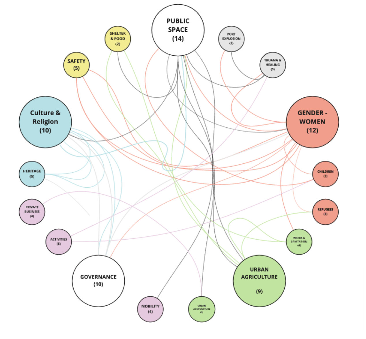
The assessments of these layers intended to identify threats and opportunities which can be further expanded in the final workshop and assist in the open space design proposals. Each layer’s diagnostic was to consider elements of social benefits, sustainability, connectivity, safety, and gender perspectives that are to contribute towards ongoing betterment suggestions. In addition, focal points from the previous workshop were aggregated and re-introduced as five major guiding research questions alongside twelve sub-topics intended to support the on-going context findings.
METHODOLOGY
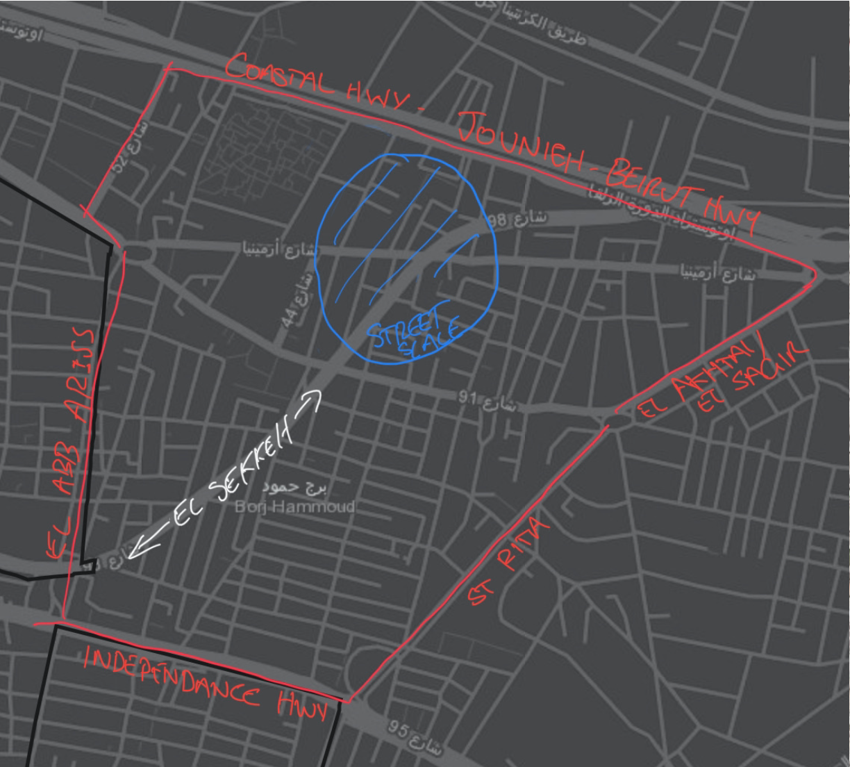
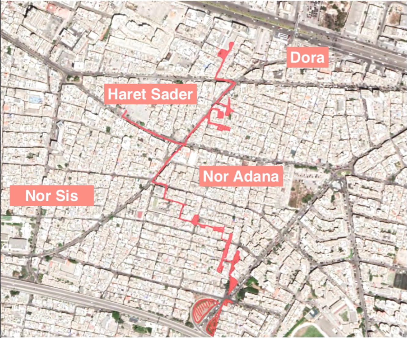
Students were first introduced to the neighborhood scale of Nor Adana, Dora, Haret Saber and Nor Sis, alongside the project layers and objectives of the workshop. They were than encouraged to self-organize into groups before being presented with data collection methodologies and secondary resources to underpin their analysis. As part of this brief, Professor Lorenzo Chelleri introduced resilience risk matrix techniques and methods for analyzing vulnerabilities and hazards. Lastly, before students broke off into 4 days of self-led research, a screening of Joanne Nucho’s documentary ‘The Narrow Streets of Bourj Hammoud’ was made available to provide crucial reference to the visual streetscape. The group work and introductory brief was held both in class and on-line at the UIC.
RESULTS
During the break-out period, the groups collaborated vital desk top research with other various information sources to build a rudimentary picture of the neighbourhood scale. They also worked on identifying the interconnectivity with the neighbourhood scale layers as well as exploring nodes and networks with greater Beirut. Ongoing feedback from Professor Gabriella Trovato and project partner NUSANED helped shape the project recommendations as well as visiting input from AUB students and their crucial personal accounts. The method of data mapping exposed the groups to some of the complexities of the field and introduced them to the themes of a rapid analysis when access to primary data is limited. Students navigated between solid secondary research and information assumptions to form a ‘best-fit picture’ to be further interrogated and refined in the final phase of the studio. In addition, their dissemination of quantitative information has helped frame the requirements for the future on-site qualitative tasks, which will aid in streamlining the in-person component and saving precious time in the pandemic compromised field. Each group presented their work with their own specific style, capturing the full scope of the objectives as well as denoting additional emergent factors not easily observed on the peripheral neighbourhood scale.
Ashley Howard – Research Assitant MICSEA UIC Barcelona