On Friday March 6, our students presented their proposals for the Montjuïc area in Barcelona prepared during the two-week socio-spatial workshop Mapping Towards Connectivity. The jury included director Carmen Mendoza, assistant director Raquel Colacios, UIC professors Marta Benages and Apen Ruiz; and Ana Paricio and Claudia Villazón on behalf of Barcelona Regional.
 Placeta de Llorca
The students’ proposals aimed to develop a new perspective for the transformation of Montjuïc into a more inclusive and diverse green infrastructure for the city of Barcelona, and to put forward potential solutions for current conflictive urban problems that bridge the social and spatial realms.

 Font de la Guatlla
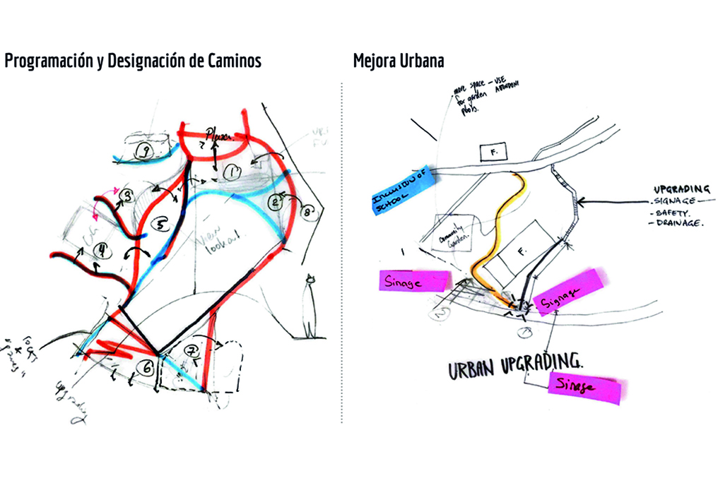
During the session, the students presented four different design concepts, one for each route related to the following access points to the green space Viver dels Tres Pins: from the Centre Civic Font de la Guatlla, the Placeta de Llorca, the Plaça del Sortidor and Mig de Can Clos. Through mapping exercises, studies of demographics, mobility and urban uses, as well as interviews with local entities and associations, neighbours and visitors, they investigated preferred connections and pathways, different uses of facilities and seemingly neglected open spaces, barriers and conflicts, and the relationship between residential and more touristic areas. To improve the connectivity and use of the green open space network on the mountain for all adjacent neighbourhoods, our students recommended the creation of alternative routes to draw people into the park and capitalise on the potentials of existing points of attraction along the journey; the creation of new facilities such as children’s play areas and dog parks; the expansion of the existing community garden into other areas of the mountain; and the revitalization of underused or neglected areas through urban acupuncture.
 Mig de Can Clos
Our guests from Barcelona Regional were impressed with the high detail of analysis and quality of design proposals for such a difficult and complex project area that is characterised by the contrast between local neighbourhoods and global city tourism, well maintained parks and empty neglected areas, and different scales, and promised to use our students work for future development plans of the area.
 Plaça del Sortidor – Poble Sec
“I truly believe that the formulation and adoption of urban policies is always a political process,” explains Carmen Mendoza Aroyo. “Therefore, the goals, methods, and urban strategies to shape equitable cities need to be driven by the urban institutions, using their tools and leading the implementation. Working at the neighbourhood scale of intervention, spatial planning tools and participatory mechanisms can initiate a path towards an inclusive physical transformation. This is what drives us to work on real projects identified by the public administration, with a socio-spatial methodology.”