
Earlier this spring, students of the Master of International Cooperation in Sustainable Emergency Architecture (MICSEA) took part in a two-week workshop in İzmir, Turkey, titled Basmane Atlas: Strengthening Urban Spaces Through Community Mapping. The studio was organized in collaboration with the Office of Displaced Designers (ODD), YAŞAMAK and AID-DER, engaging students in a grounded exploration of Basmane — a historically layered neighbourhood shaped by migration, informality, and resilience.
Students worked in four thematic groups — Typology, Mobility, Open Spaces, and Services & Activities — each following a five-step methodology:
- Offsite spatial diagnosis: developed before the visit, analysis of existing plans of the area.
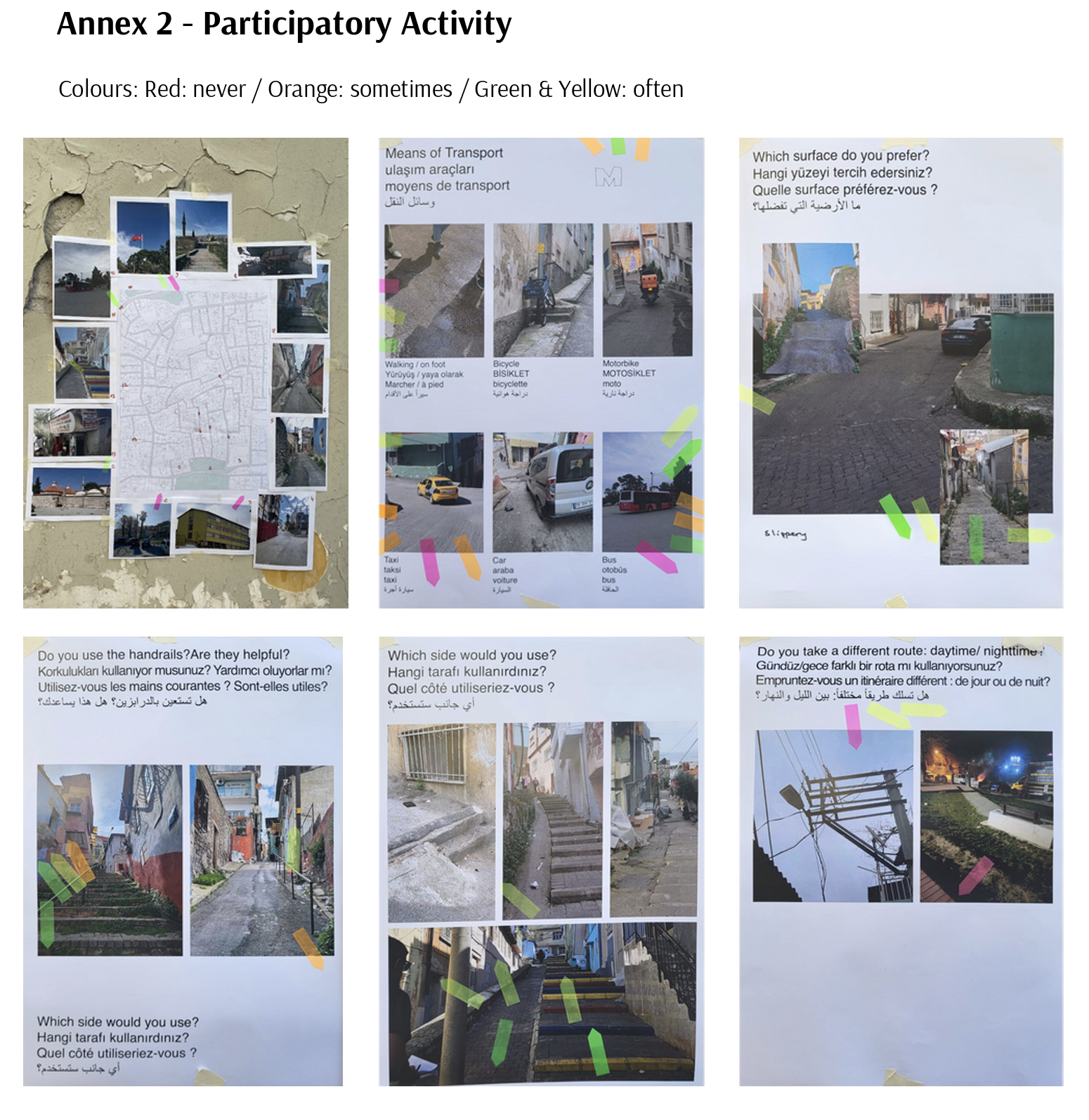
- Onsite mapping and assessment: fieldwork plan that outlines objectives, tools, and methods for observing and collecting data related to each group’s specific focus. Ensure the plan is reviewed and finalized before beginning fieldwork. + further research depending on group.
- Onsite Stakeholder and community engagement: walkalongs + photography workshop + semi-structured interviews with partners.
- Onsite Synthesis and spatial analysis and Strategic design proposals: analyze collected data and propose small scale strategies.
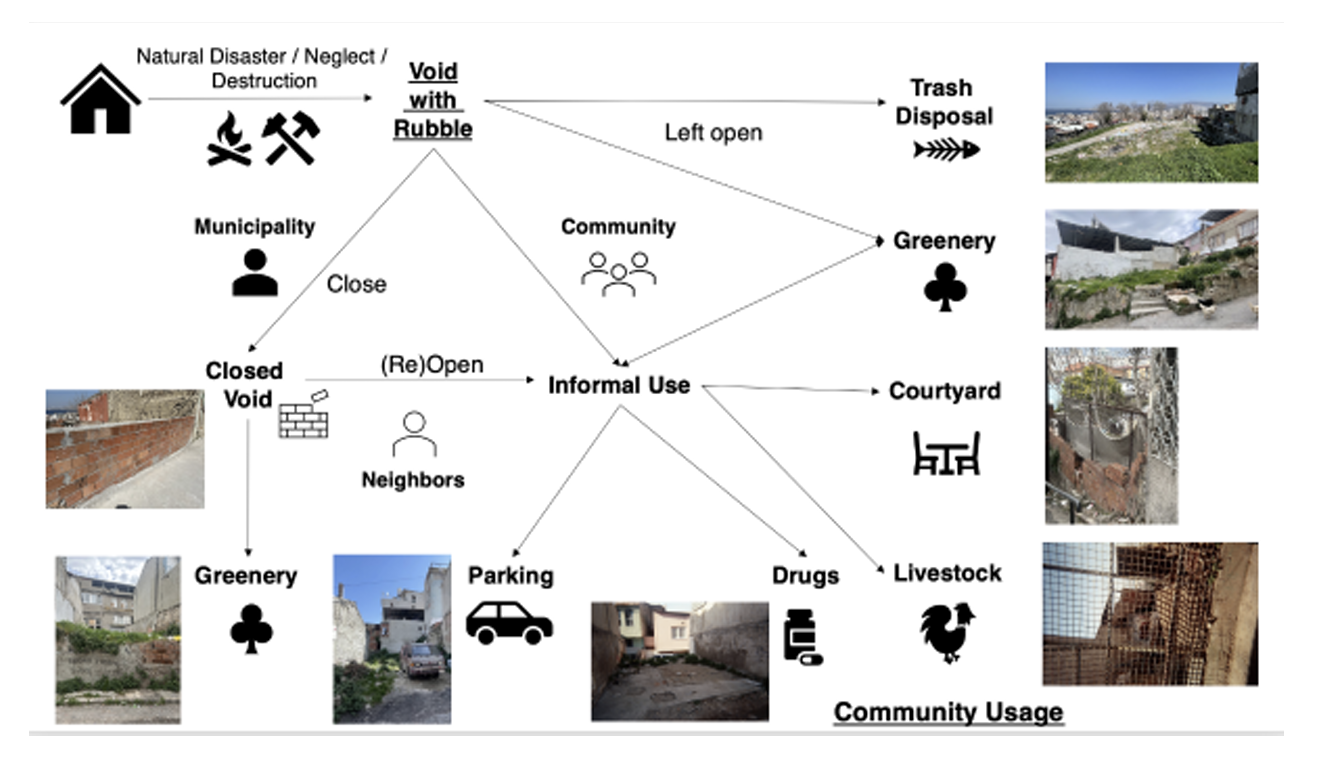
TYPOLOGY analyzed domestic and commercial spatial patterns to understand how housing and economic activity adapt under migratory pressure.

MOBILITY explored patterns of movement and accessibility, identifying key bottlenecks and informal paths used by residents, particularly vulnerable groups.

OPEN SPACES studied the limited yet vital public spaces in Basmane, proposing interventions that foster inclusivity and sociability.
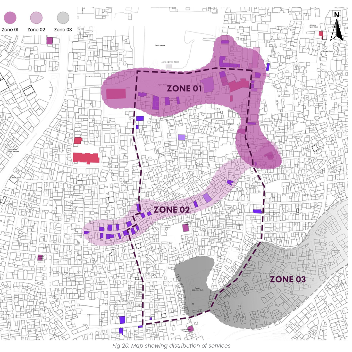
SERVICES AND ACTIVITIES mapped local institutions and informal support networks, revealing where gaps persist in access to education, health, and cultural expression.


Throughout the process, students faced the ethical complexities of working in displacement-affected contexts. Multilingual communication across Arabic, Turkish, and English posed barriers, while scepticism from residents reminded them that mapping and research are not neutral acts. Nevertheless, moments of connection — shared meals during Ramadan, storytelling, and creative workshops with children and youth — opened space for dialogue and learning.
Their final proposals aimed not only to visualize spatial conditions but to support local NGOs with actionable tools. The resulting community maps and contextual spatial analyses provide our collaborating organizations on the ground with clearer data to scaffold future interventions grounded in community realities.
Ultimately, this fieldtrip was not only a design exercise — it became a lesson in humility, trust-building, and the ethics of engagement. Students left with a deeper understanding of the spatial borders and listened to challenges faced by refugees and migrants in Basmane, and of how architectural and urban tools can become instruments of support.
What emerged was not only a set of design proposals, but a more grounded understanding of what it means to engage respectfully and adaptively in uncertain settings — where trust must be built slowly, and where listening requires time, care, and context.